01
Unified live map
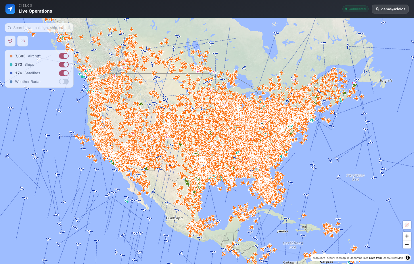
Combine aviation, maritime, satellite, weather, marker, and team context in one map workspace.
LIVE GEOSPATIAL OPERATIONS
Cielos.ai brings aircraft, vessels, satellites, weather, team markers, trips, and share links into one authenticated operations workspace.
PLATFORM
Bring every live layer, lookup workflow, team update, and recorded route into a focused workspace that stays private by default.
Combine aviation, maritime, satellite, weather, marker, and team context in one map workspace.
Turn operational layers on or off depending on the mission, audience, or team preference.
Protect live positions, team movement, private markers, searches, and operational records behind authentication.
USE CASES
Cielos.ai is built for situations where map context, identity lookup, team notes, and trip history need to stay together.

Also on iOS
The full live operating picture rides along on iOS — real-time aircraft, vessel, and satellite layers with your own position on the same map.
Coming soonon the App StoreQuestions, answered
Live geospatial operations software for aircraft, vessel, satellite, team movement, trip recording, and public sharing workflows.
No. Live workspace data, searches, team activity, markers, dashboards, and saved operational records require authentication.
Bring every live layer, lookup workflow, team update, and recorded route into a focused workspace that stays private by default. Key capabilities include Live geospatial map, Aircraft tracking, Vessel tracking, Satellite tracking, Team markers, Trip recording.
Yes. Authenticated users can create controlled, read-only links for a selected live location or recorded trip without exposing the rest of the private workspace.
One operating picture
Start with the live map, then move naturally into identity, analysis, coordination, route history, and controlled sharing.